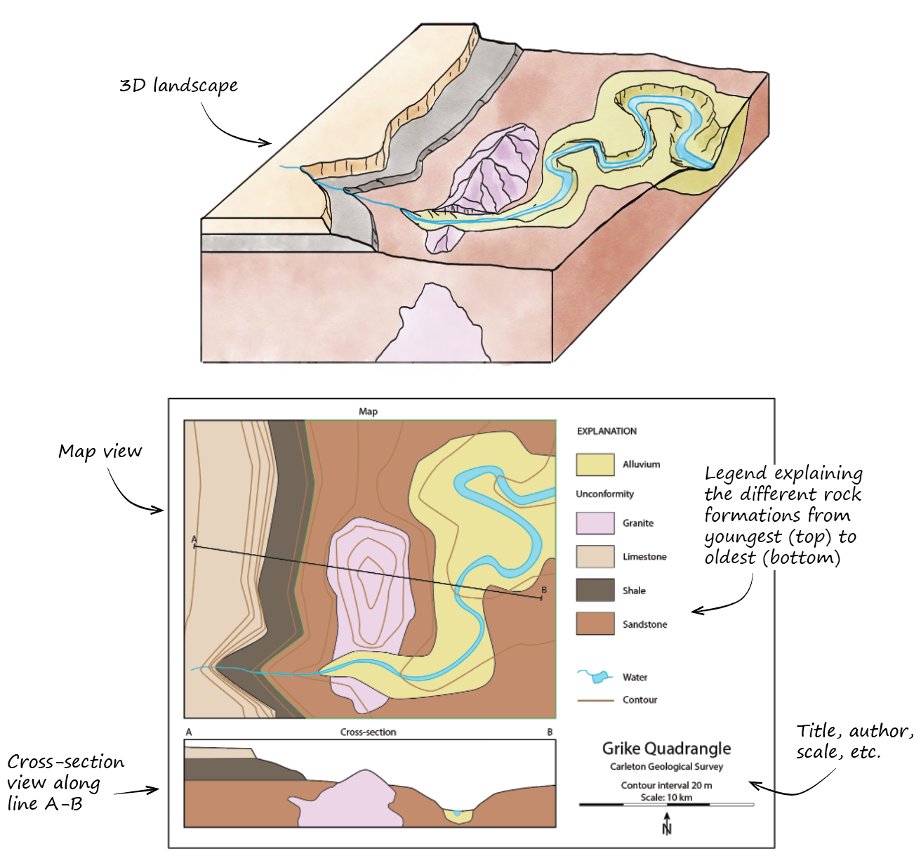
Introduction to reading geologic maps.
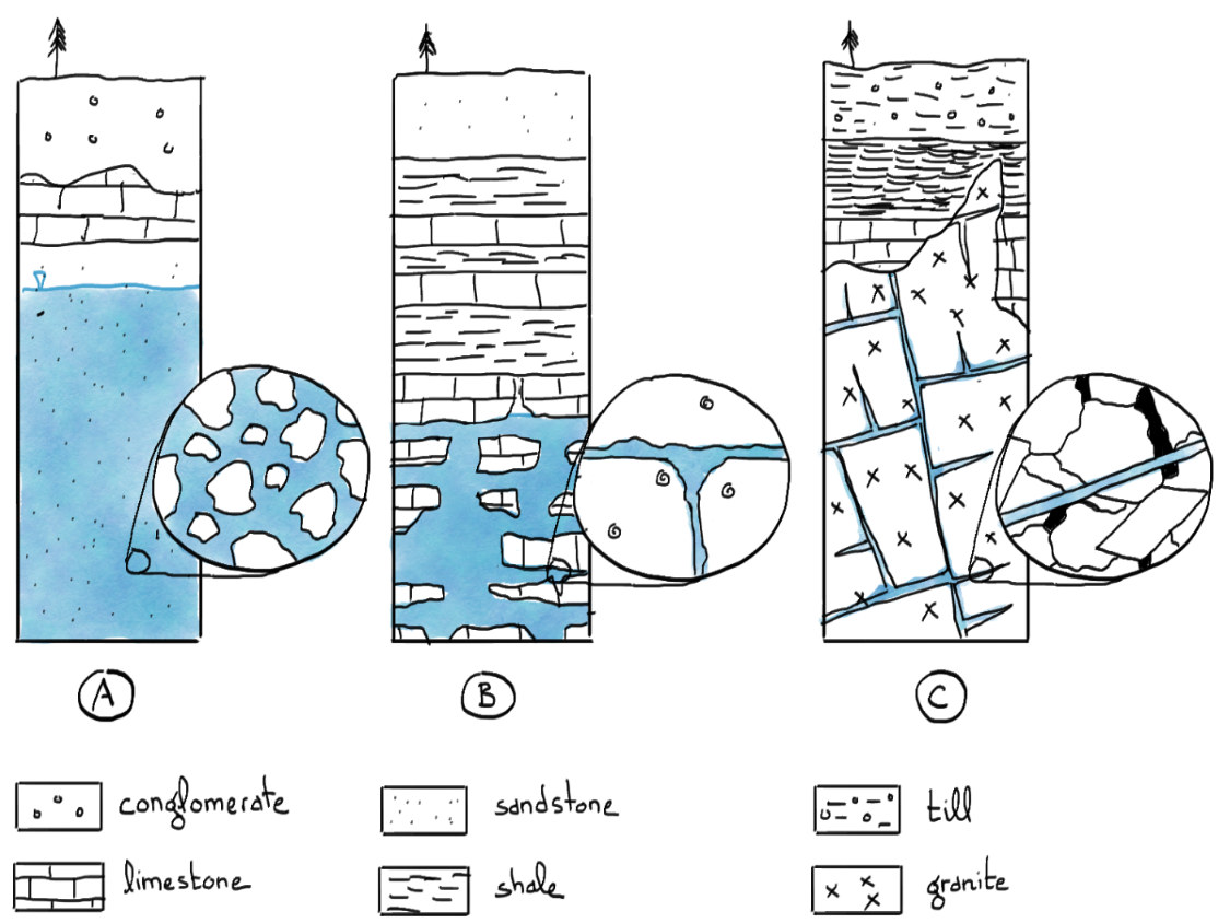
What are the advantages and disadvantages of each of these aquifers as a potential drinking water source?
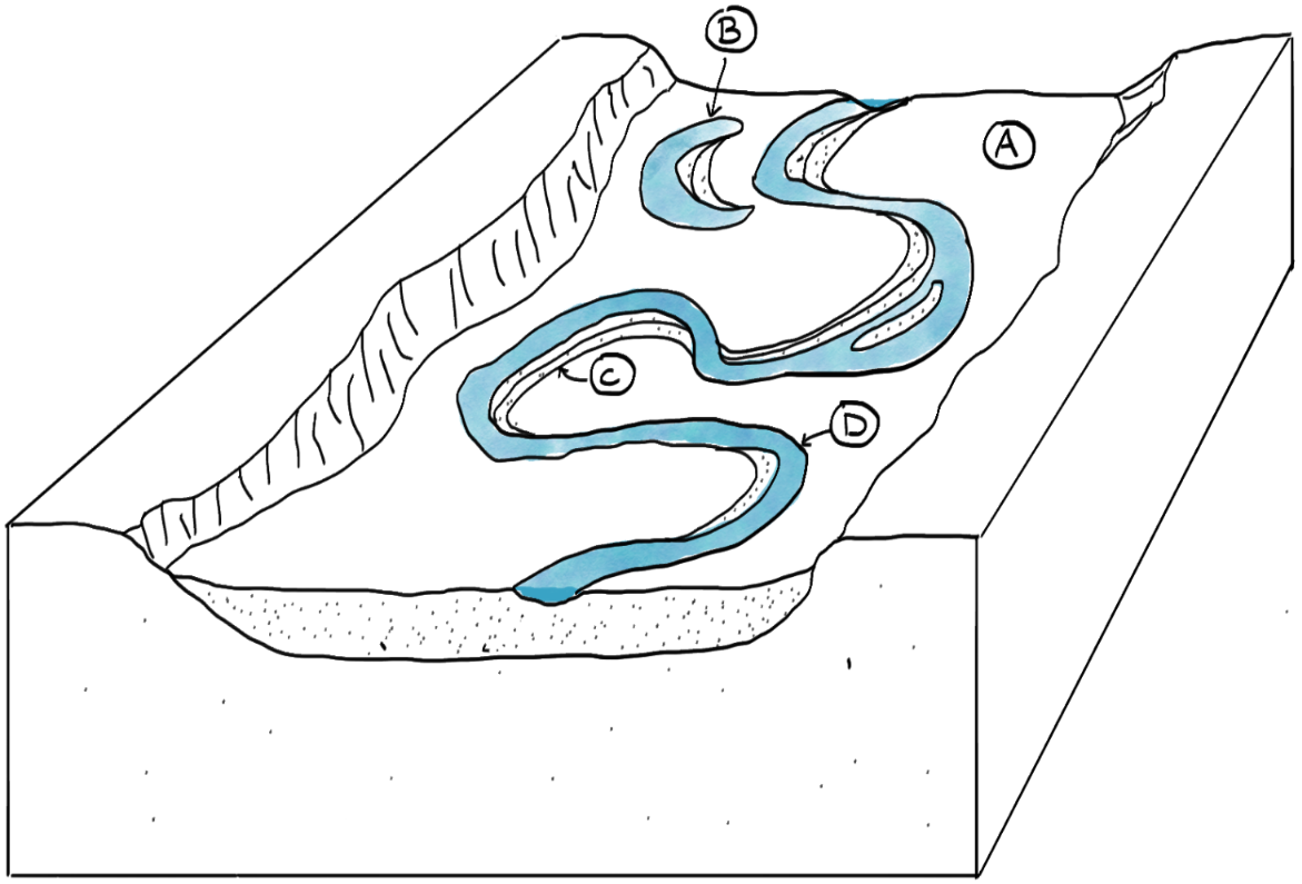
Identify the fluvial geomorphologic features labeled in this diagram.
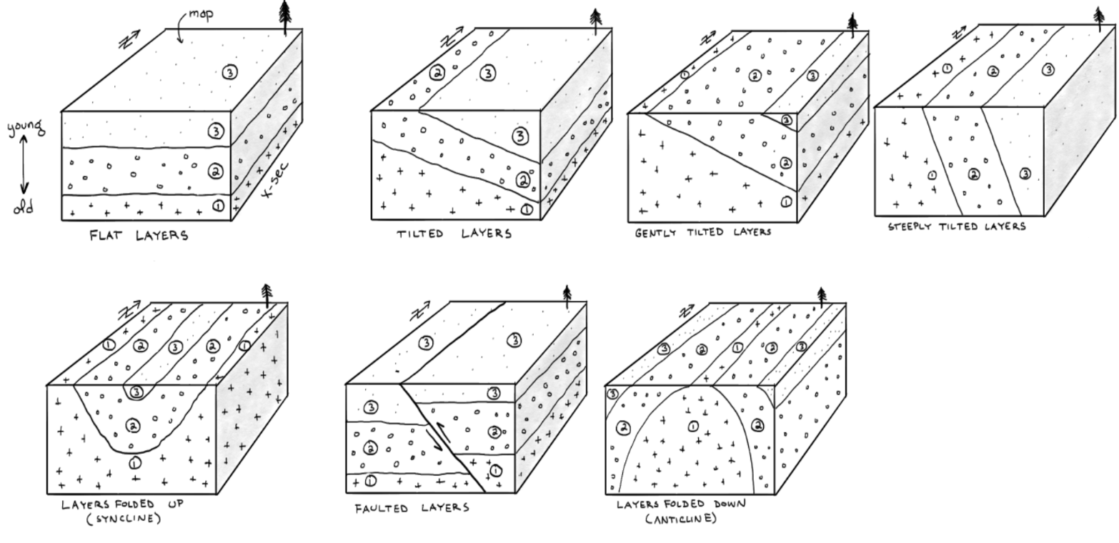
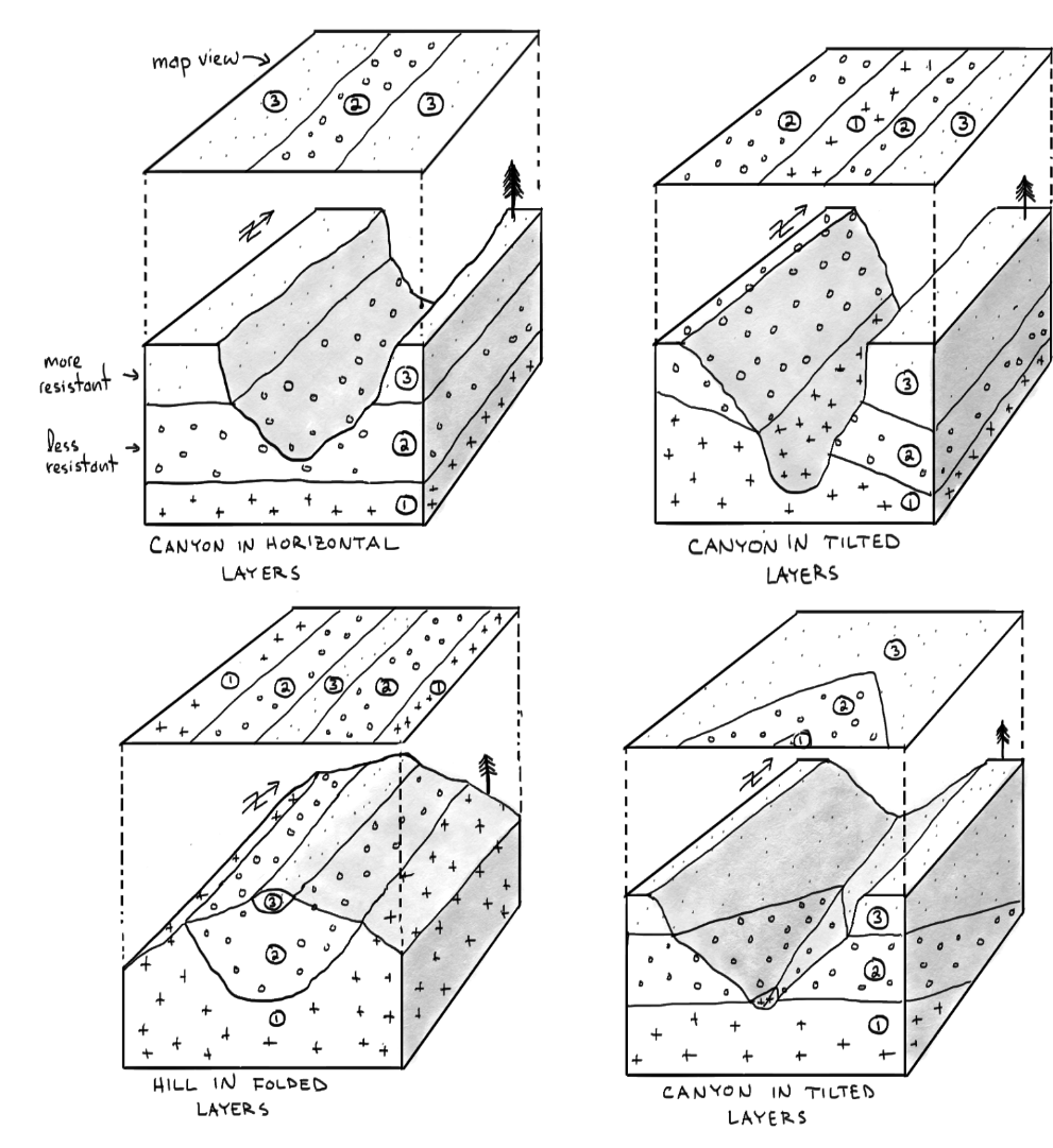
Examples of what different geologic structures look like in map view and in cross-section.
Examples of more complex geologic and erosional features in map view and in cross-section.
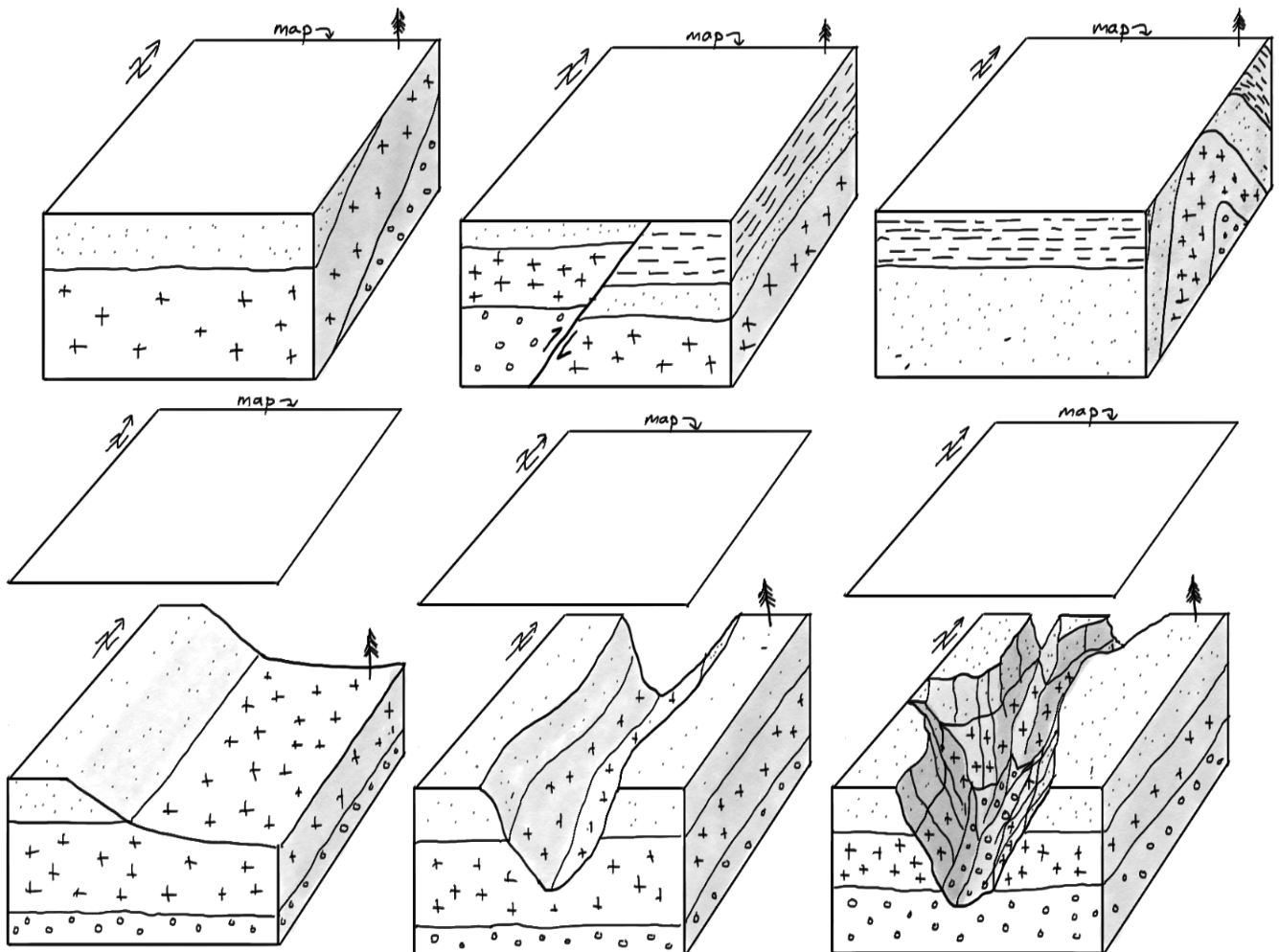
Draw what each block diagram would look like in map view in the blank spaces provided.
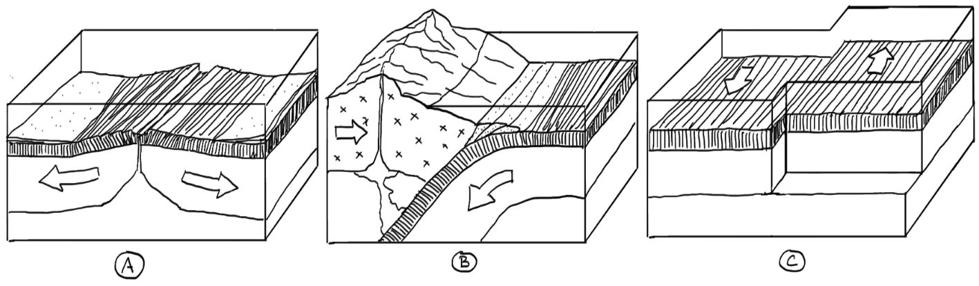
What type of plate boundary is represented by each diagram?
Classroom exercises
A collection of examples and unlabeled diagrams used for in-class exercises. Students are asked to identify important features, or to make interpretations based on the diagram they are given. Examples of accompanying questions include: Which of these aquifers would be best suited for drilling a drinking water supply well? What type of plate boundary does each image represent? Draw a map view of the geologic structures depicted in this block diagram. Etc.